Sat 3rd Nov - Sun 4th Nov, 2001
Ty Powdyr, Bonfire & Navigation Course
I've been lazy about hill navigation. Crags 300 ft high are difficult to miss, and if they are more than a mile from the car I'm not going there anyway. On a KMC walk, there are so many ace navigators I can just follow and admire their precision. So Dave's course was a good chance to get a new skill.
I think we all learnt a lot, but for me the special points were:-
- Use distance as an aid to location. Somehow I had never previously got the feel for this from 1:25,000 maps.
- Carry a magnifier, or my mother's reading glasses, and use all the detail on the map.
- Look at the contours on the map, and visualise what that is going to look like on the hillside. This is going to need lots of practice.
- Look for "ring-cons" and other peculiarities of the contours as an aid to location.
- Don't be over-confident that I know just where I am, and especially don't try to "make" the map fit if there is a permanent feature that doesn't.
- Don't hesitate to "aim off" - it works just as well walking as sailing, and is especially useful in the dark and presumably in bad visibility.
- And by the end of the day: waterproof maps are well worth the extra.
- Steel myself to cut them up - seems like sacrilege, but it is just so much easier in the wet and wind to whip out a folded-up A4 bit than the whole Explorer sheet. And the other parts stay dry and un-frayed.
Thanks Duncan for organising the course and Dave Kenyon for taking two parties out on consecutive damp days.
Roger Dyke
Roger D
Members present: Jim Gregson, Sandy Gregson, Robert Clark, Al Metelko, Dave Wylie, Alan Wylie, Sheena Hendrie*, John Castick, Virginia Castick, Joanne Castick*, Michelle Harvie*, Mark Garrod, Lee Wood, Sue Brooke, John Dobson*, Dave Shotton*, Chris Williamson, Mark Ashley*, Andrew Croughton*, Dave Lygate*, Joe Flynn, Anthony Mannion *, Lester Payne, Craig Marsden, Sue Marsden, Zoe Talks*, Martin Heaton, Roger Dyke*, Kevin Anderson, Colin Maddison and Duncan Lee (31).
Guests Present: Fay Castick, Ian Dobson*, Rosemary Gibson, Martin Willcox, M.Green, Kate Sparks, Phoebe Marsden, Thomas Marsden, Alexis*, Tony*, Steve Chandler*, James Richardson*, Roisin Maddison and Dave Kenyon* (14).
(*Denotes those who braved the navigation course.)
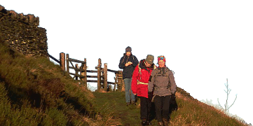
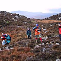
A meet that must have warmed the cockles of The Hut Treasurers heart saw the hut busy on both nights. Saturday saw 8 hardy souls heading out to The Moelwyns with Dave Kenyon for the Navigation Course and amazingly enough he even brought 8 people back who all seemed to have enjoyed themselves. Luckily for Dave, Michelle had already been for a run in the quarries prior to the course, so she could not run off as quickly as usual in the opposite direction. It should be noted however that Hurricane Michelle did cause havoc in Cuba the following day. She was supposed to have been going back to the Moelwyns with Mark G.
Team Wylie with a variety of helpers busied themselves during the day preparing the Bonfire whilst the less public spirited amongst us snuck off into the hills to walk or climb whilst sampling some of Snowdonia's finest traditional weather. Horizontal heavy drizzle, that provided ideal conditions for a bracing walk, or a mountaineering day in big boots. One group of walkers, who will remain nameless, demonstrated that they should have been on the Nav. Course rather than on The Glyders by following a County boundary rather than a footpath for a mile. JOE, remind Martin next time to a) not follow you and b) to put his camera inside a plastic bag in future.
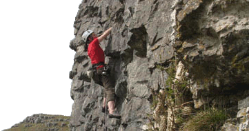
The rufty tufty mountaineers headed off to the mighty precipices of Tryfan to thrash, grovel, slip, slide, swim and squirm their way up a couple of classics. Direct Route on Milestone Buttress followed by Gashed Crag on the East Face which provided great amusement where "the roof of the Gash halts progress on the ridge but out of sight, round to the right, is a chimney. This is so smooth and tight that it can easily become a very personal struggle." Al and I, who had the pleasure of leading that pitch, can testify to the accuracy of that particular gem of wisdom gleaned from the pages of the guidebook after the event.
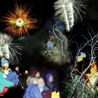
The evening saw all and sundry trying to warm and dry themselves around the bonfire whilst the Wylie firework display was as entertaining as ever.
Sunday saw another intrepid bunch; nursing hangovers, disappear off into the mist in The Moelwyns with Dave whilst others just disappeared home. Jim and Sandy tested the strength of the wind on Carnedd Daffyd whilst the Wylie brothers explored out of the wind in some strange old ammunition stores near the DMM factory. A group of walkers headed to the Moelwyns to sabotage the nav. Course whilst Kevin, Al, Lee and Robert ventured up The Pass to Clogwyn Y Grochan where they ascended Karwendel and Kaisergebirge Walls during a break in the monsoon. Colin and I made use of the same weather window by climbing Direct Route on Dinas Mot. The rain set in in earnest in the afternoon providing Dave K with perfect conditions for navigation and a damn good excuse to go home for the rest of us. Thanks to everyone who turned up and helped ensure that the bonfire and navigation courses were both enjoyable.
A select team even stayed on for the Monday. Rumour has it that Hurricane Michelle and Mark squeezed in a quick ascent of Flying Buttress on the Cromlech before rain stopped play.
Duncan Lee
Meet Promo:
This is a meet that runs itself, but be prepared to get your hands dirty building the bonfire and then watch the pyromaniacs in the club struggle to get thing burning. Oh! Don't forget to bring some fireworks remembering that vast quantities of little ones will keep the above same pyromaniacs occupied for hours. Not recommended if you are of a nervous disposition.
Compass Navigation
The course will be a full day starting at 9:30am from the hut and cost £10 per person with a maximum of ten people per day. If demand is high enough Dave will run the course on both days of the weekend. Anyone interested should contact Duncan by phone or email, or come down to the pub.
After a hopefully brief introduction to basic navigation, making sure that everyone is familiar with the basics (Map scales, Distances, Symbols, Features, Contours etc), the day will be spent on the hill. We'll be looking at some of the features on the map and seeing how they relate to what's happening on the ground, as well as more advanced techniques such as Timing, Pacing, Handrails, Attack points, Aiming off, Aspect of slope, etc, etc. The location will depend on the weather and what people would most like to look at.
You will need to come well prepared, as we'll be standing around (discussing/arguing!) quite a bit and not walking huge distances. We'll go out no matter what the weather, the worse the better as far navigation goes, you'll need:
- Rucksack
- Waterproof Jacket & Trousers
- Good boots (Gaiters)
- Hat & Gloves
- Spare warm clothing
- Flask & Food
- Spare Emergency food (Date bars, Kendal Mint cake, Mars bars etc)
- Small personal First Aid Kit
- Marker Pen - Fine Map marker or OHP pen
- Head Torch with a new or spare battery
Compass
Preferably a Sylva type 4 or Sunto do a very similar one. Key features are:
- It needs to be a reasonable size about 120mm/5 inches
- An easily readable compass housing or dial (preferably in Degrees not Mills)
- Magnifying Glass
- Direction Arrow
- Romer Scales (1:50,000 & 1:25,000)
- Ruler in mms
- Orienteering Lines inside the Compass Housing
Maps
- 1:50,000 Snowdon and surrounding area (Sheet No 115)
- 1:25,000 Snowdonia Snowdon and Conwy Valley areas (Sheet No 17)
Useful Books
- Mountain Navigation by Peter Cliff
- Mountain Navigation Techniques by Kevin Walker
- Mountaincraft and Leadership by Eric Langmuir
- Ordnance Survey Map Skills by C Warn
Maps and compasses and any other gear can be hired from the Brenin in advance. It is recommended to read up as much as possible before the course.
Duncan Lee
